
This was a day we were very much looking forward to. We knew about it a week in advance and had already made our plans. The GFS runs were indicating a promising day. Frigid air was flowing NW to SE and was due to cross Ireland and UK on March 3rd. We could expect wide spread cold air convection which should produce some nice cells, hail, snow, and even some thunder. The updated ESTOFEX forecast showed a large section of t-storm potential flowing down the whole western side of N. Ireland and the Republic. Unfortunately our location in Maghera, Co. Derry was outside this risk box but we were not too concerned about this as the weather is way too unpredictable. This would be our first official chase of 2008. Conor Mc Donald and I planned to spend the whole day doing storm photography from the top of Slieve Gallion mountain, Glen Shane, and just about anywhere else we wanted. It promised to be a fun day. During the evening of the 2nd things were already beginning to happen. I was in Draperstown with my mum visiting a graveyard when heavy hail and snow began to fall. Within minutes the hills had turned white. The air was bitter, you could really feel that cold air from Scandinavia moving in. The Met Office had issued a weather warning for the night hours when we could expect between 10 and 15 cm of snow and blizzard conditions. During the early part of the night I sorted out my gear and charged two sets of batteries in preparation. I got a phone call from Conor, due to a mechanical set-back we now wouldn't have a car for tomorrow's chase which was a little disappointing but we were not worried because the weather was heading for us anyway. We would have to do this the old fashion way by walking to the country which has its advantages. Time would tell. We had a good feeling about the synoptic forecast and we were very excited...
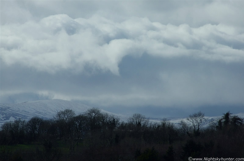 |
Now looking west over the Cairn mountain range also covered in snow. Nice cumulus cloud structure here. The curled form pointing down really caught my attention. Note also the low visibility above the hills. That's the first visual sign of a snow storm arriving in from the northwest. This was taken with the 300mm zoom lens hand held. Difficult shot because I was shivering.
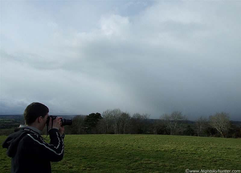 |
Very large cells arriving now and taking us by surprise. Facing north from the original vantage point. You can see the eastern section (using astronomical compass points) of the sweeping anvil here with heavy snow falling in the distance and heading our way fast. There's Conor in action.
 |
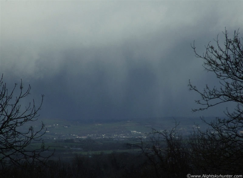
Facing SW again. This massive cell had arrived from over the mountains. It's moving to the left here, slowly. The cumulus clouds in the middle are actually the gust front at the leading edge marking the out-flow region. Look at the incredible, dark, dense core of hail and snow blasting the mountains from the base of this wonderful structure!. The black spots on the image are actually giant snow flakes back-lit by scattered sunlight. They were so big that they look like a swarm of bees here. No flash used, this indicates their large size - the biggest snow flakes we have seen to date. I think this was using the 150mm.
 |
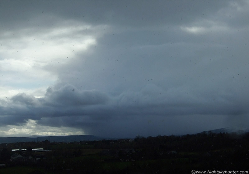
This is the leading (S) section of this massive gust front. It looked very menacing now as it crept slowly from L to R (N to SE). This thing is miles long!, that's heavy snow/hail falling down. Look at the size of the distant houses (white forms) in comparison to this monster. Image overexposed at the top here. Getting images was a real challenge due to the large dynamic range of light. The top was white and the underside was black as night and the dense snow curtains varied from black, grey, silver and white in colour. This is a lot for a camera to handle.
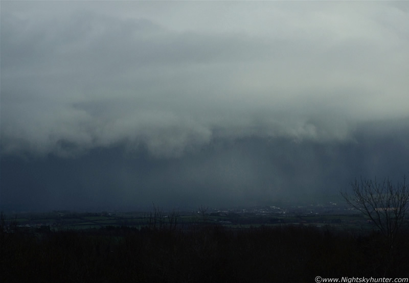 |
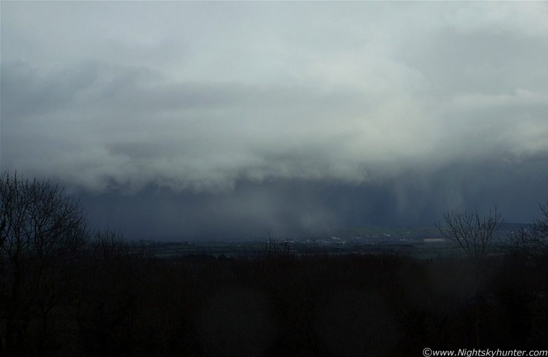
A little closer. Snow darker to the left and better structure on the shelf starting to reveal itself.
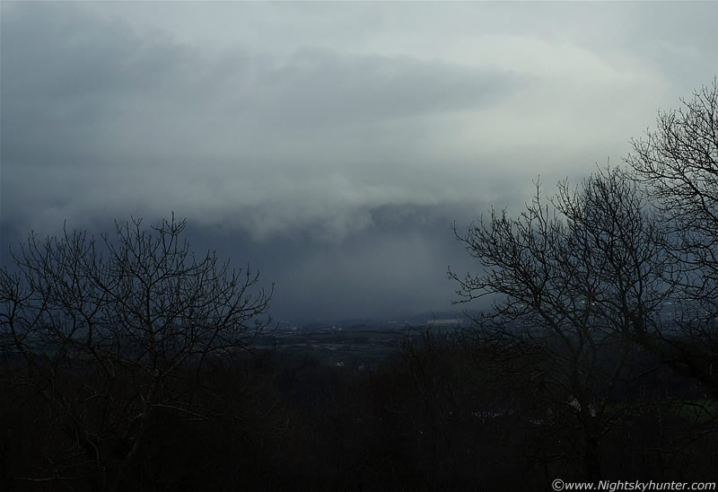 |
Closer again. This looked like a living, breathing structure. It reminds me of a great white shark with jaws open wide ready to attack. The ragged cloud are the teeth and the prey is the countryside and houses.
 |
That's pretty scary looking. There's serious snow and hail transforming the green fields in an instant. If you lived in one of those houses and looked out of a north facing window now you would see a very eerie darkness with snow splatting against the glass. If you had looked out 20 min's earlier you would have had a mind blowing view of the gust front as it came toward your home. You would see the entire curve of the structure hugging the ground like a giant wall of cloud. It's shaped like an arc hence the name 'Arcus' or 'Shelf Cloud'.
 |
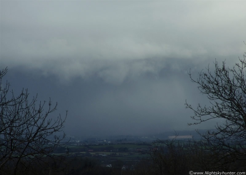
Close in on the heavy shafts of snow and hail at the leading edge. The Sun popped out to illuminate the land for me. This is with the 300mm. The 'shark's teeth' are at work! I was amazed to see the snow hitting the ground and getting swept back upward ahead of the cloud in the direction of its movement to the right. I made a reference to this on the video clip at one stage. It was great to see the out-flow in action as cold air was forced downward and outward from within the clouds belly. This cool air is pushed ahead of the cell where it meets warmer air over the ground. The snow was carried along by the cool air and revealed its dynamic dance to my eyes.
...At night the temp dropped in a serious way. During the early morning hours my sister and I went for a walk through the country. There was a severe frost and the clouds were thick. Suddenly the lights over a wide spread area went out and we were plunged into darkness! - it was 02.00 UT. It was pitch black from the country and since there were no gales I suspected lightning activity was responsible. A heavy snow storm began to fall and within a minute the narrow twisting country road was turned a wonderful white and framed on both sides by tall dark trees. Beforehand we couldn't even see the road with dark adapted eyes but the snow coated the ground revealing a white track cutting through the darkness which was very magical. When I got home at 03.00 I logged on to the UKWW forum and was informed by Dave Clarke that there was recent T-storm Sferics reported to the SE of Derry. It was lightning which caused the black out!. I later learned that Dublin experienced quite a violent thunderstorm during the night. At 03.30 a tremendous blizzard hit for five minutes fueled by raging gusts of wind. I retired to my room but kept the blind up so I could watch the sky from the comfort of my bed. At 05.00 a blinding blue flash of lightning lit up the low NE sky which caused another power failure. This was getting quite exciting and I felt encouraged about daylight only a few hours away.
(Above) Youtube video nearly 10 min's in duration showing us watching convection and the giant shelf cloud. Grab a brew and enjoy. Continued on page 2.